West Cork is full of majestic walkways that meander through towns, villages, woodlands, fields, hills and valleys inland or along it’s spectacular coastline. Here are just ten great options to put on your list for 2022.
***
This article was originally published in our Get Active 2022 magazine which can be read in full here.
ADVERTISEMENT
***
1 | Bere Island – part of the Beara Way
The Beara Way is part of the Beara-Breifne Way, a route that follows the march taken by Donal O’Sullivan Beare and supporters in 1603. In its entirety it is approximately 220km long, from Glengarriff to Kenmare and back. Interestingly, Bere Island is included and has two loops.
LENGTH/DURATION: Ardnakinna Loop – 3-4 hours | East End Loop: 2 hours.
DIFFICULTY: Both routes include roads and off-road terrain, with some hilly areas, suitable for moderate abilities.
DIRECTIONS: Head for Castletownbere along thescenic Beara peninsula and take the short ferry trip to Bere Island.
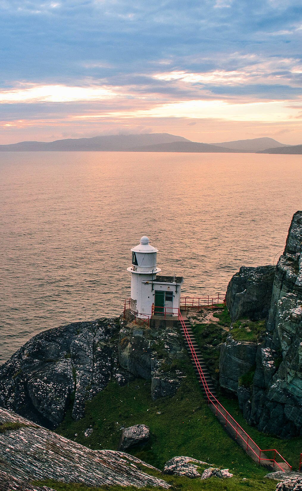
2 |Lighthouse Loop – Sheep’s Head
The full Sheep’s Head walking route is 93km long and includes a mix of old boreens, woodland and grassy paths, hills and quiet roads. It has been broken down into a number of shorter loops of varying lengths.
The Lighthouse Loop Walk, taking in a visit to the iconic lighthouse at the tip of the peninsula, is must-do.
LENGTH/DURATION: 4km, approximately 1-2 hours.
DIFFICULTY: A hike with some rough and rocky terrain. A reasonable level of fitness required. Stick to the trail and be mindful of the weather, unprotected cliffs and boggy conditions.
DIRECTIONS: Drive south west along Sheep’s Head until you reach Tooreen Turning Point car park (the furthest point by road on the peninsula). Waymarked by blue arrows.
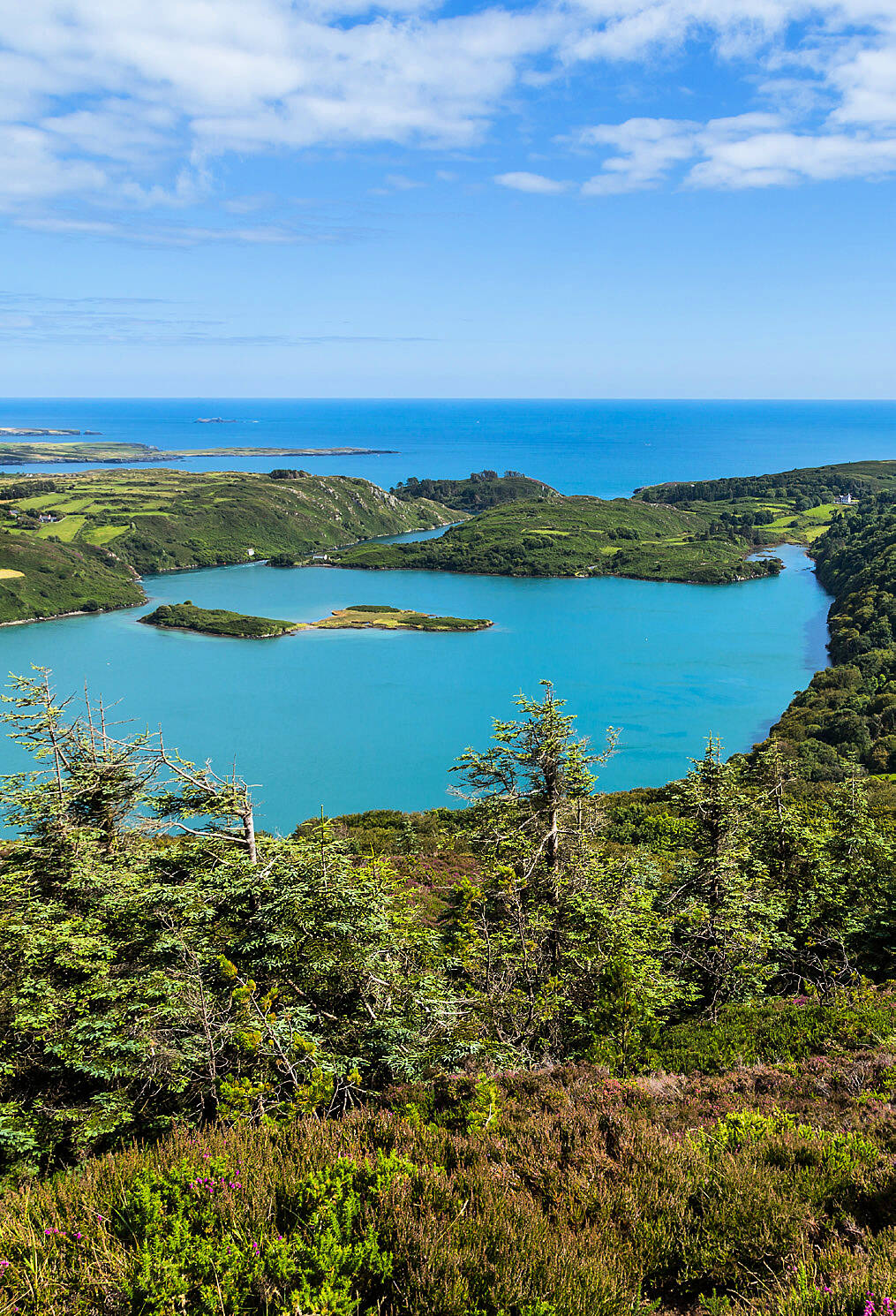
3 | Knockomagh Hill – Lough Hyne
A walk up Knockomagh Hill is worth it for the view from the top. Overlooking Lough Hyne Marine Nature Reserve, the hill is 197m high and the walk takes about an hour in total.
There is a clear path through the wood to the top, with panoramic views from Galley Head to the east right out to Cape Clear and the Mizen Peninsula to the west on a good day.
There are car park spaces at the foot of the hill, as well as nearer to the lake.
LENGTH/DURATION: 1 hour approx.
DIFFICULTY: Easy to moderate. Some steep steps in places but generally suitable for most fitness levels.
DIRECTIONS: Head out of Skibbereen towards Baltimore and turn left (signpost for Lough Hyne) shortly after passing the golf club.
4| Carrigfadda Hill
Carrigfadda is located between Reenascreena and Drinagh, about 10km from Rosscarbery.
Here amongst the forest lies a hill that is 313m high.
There is a 7m high Marian cross near the top, from which, on a clear day, there are views of Galley Head, the Old Head of Kinsale, Mount Gabriel and Cape Clear.
LENGTH/DURATION: Length/duration: 3.7km, 2 hours.
DIFFICULTY: A hill walk along a path with a strenuous climb towards the summit.
DIRECTIONS: Directions: Start/finish at Carrigfadda Church car park outside Reenascreena.
5 | Knockaphuca Loop – Fastnet Trails
5 | Knockaphuca Loop – Fastnet Trails The Fastnet Trails comprise a range of short and long nature walks in the areas of Aughadown, Ballydehob, Lisheen, the Butter Road, Schull and Toormore.
They cover a total distance of 80km. The Knockaphuca Loop, which starts in Goleen village is a great walk but a good test of ability and fitness.
LENGTH/DURATION: 10km walk/hike and takes about three hours
DIFFICULTY: Strenuous. The trail goes from sea level to the 237m summit of Knockaphuca. The loop is made up of road, grassy tracks, open mountain and rocky terrain.
DIRECTIONS: Waymarked (red arrows, white background) from Goleen village on the Mizen peninsula.
6| Fuchsia Walk – Coppeen Waymarked Walks
There are four themed routes, all starting and finishing in the village of Coppeen,.They vary from six to over 12km. The Fuchsia Walk is 6.6km long and the route is marked with red arrows.
There is a viewing point en route where both Cork and Kerry hills and mountains can be seen. All of the Coppeen routes are along roadways, so care is advised.
LENGTH/DURATION: Fuchsia Walk, 6.6km.
DIFFICULTY: Easy-moderate with gentle inclines. Mostly on quiet roads, with the exception of the last stretch which is on a main road, so take care and be aware of traffic.
DIRECTIONS: Starts and finishes in the village of Coppeen, north of Ballineen
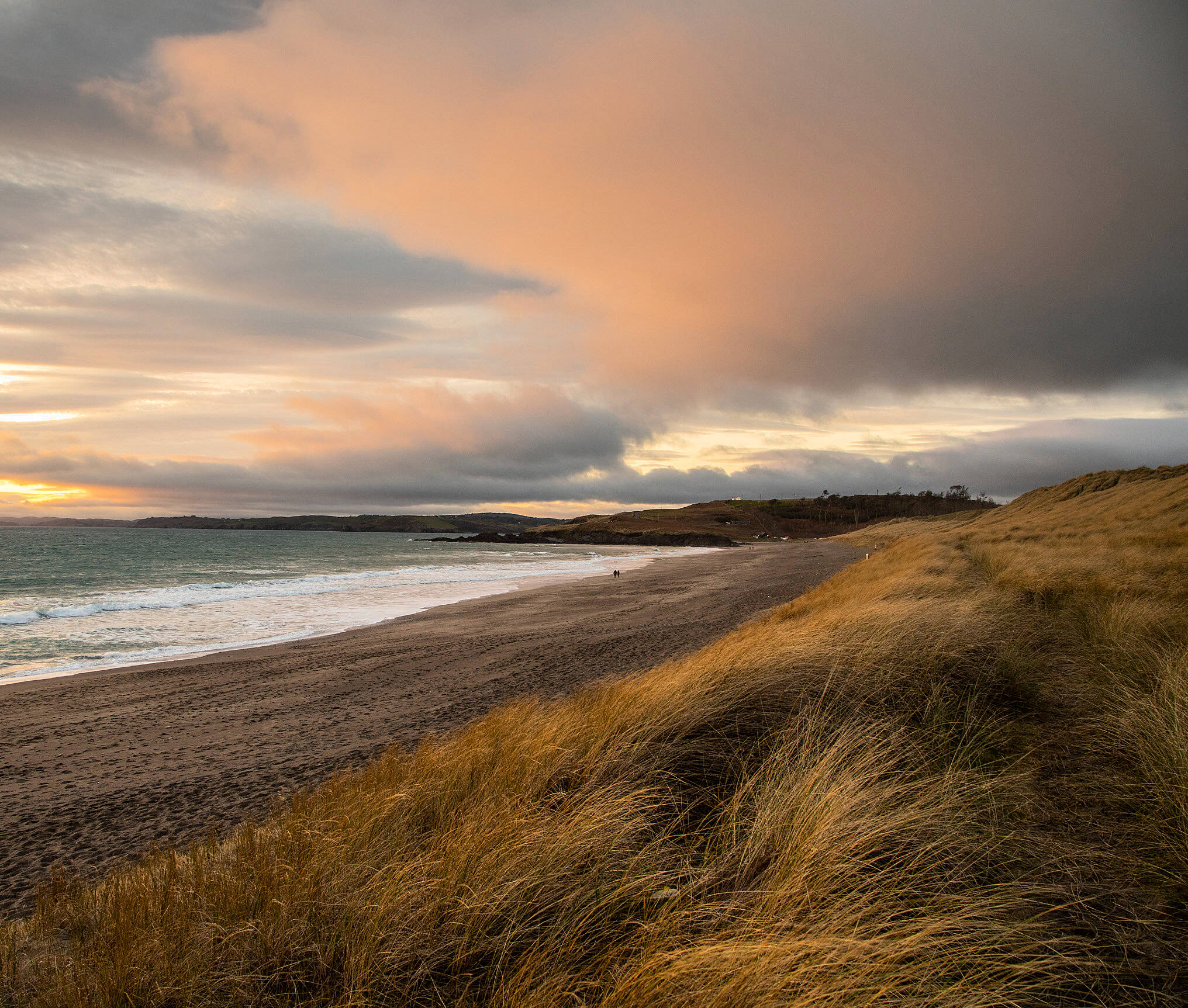
7| Long Strand
Long Strand, which is in fact, a mile and a half long, is a treasure for walkers.
There is plenty of space for the whole family for a nice beach stroll, with lots of meandering paths in the dunes if you’d prefer something with a bit more variety.
There is a large car park next to the beach and there are multiple routes you can take from here.
You can stick to just the beach, add on the loop around Kilkern Lake or extend your walk through Castlefreke Woods and visit the High Cross with views of Galley Head, Rosscarbery and beyond.
LENGTH/DURATION: Varies depending on the route you choose but the beach itself will take an hour approx. over and back.
DIFFICULTY: Easy to moderate.
DIRECTIONS: Head west from Clonakilty for about 15 minutes along the N71 and turn off left shortly before reaching Rosscarbery. Drive through Ownahincha and up over the coast road for a couple of minutes – you can’t miss it!
8 | Drimoleague Heritage Walkways
With a choice of six different routes, the Drimoleague Heritage Walkways offer something for everyone. One of the more challenging routes is the Mealagh Valley Walk from Coomanore to Kealkill.
You will be immersed in history and heritage and will see mountains, woodland, a megalithic tomb and a stone circle.
The Drimoleague Heritage Loop is an easier route starting in the village. The pathway to the Top of the Rock is steep on this walk but the views are worth it.
LENGTH/DURATION: Mealagh Valley Walk, 10km, 3.5 hours. Drimoleague Heritage Loop, 2 hours.
DIFFICULTY: Mealagh Valley Walk is a challenging hike with some soft terrain so a good level of fitness/ability required. The Drimoleague Heritage Loop is shorter, but with some steep sections. Suited to moderate levels of fitness.
DIRECTIONS: Mealagh Valley Walk – travel out of Drimoleague along Quarry Road for about 20 minutes to get to Coomanore Lake. Walk starts here and ends in Kealkill. The Heritage Loop starts at the Railway Yard in Drimoleague village. Both walks are waymarked.
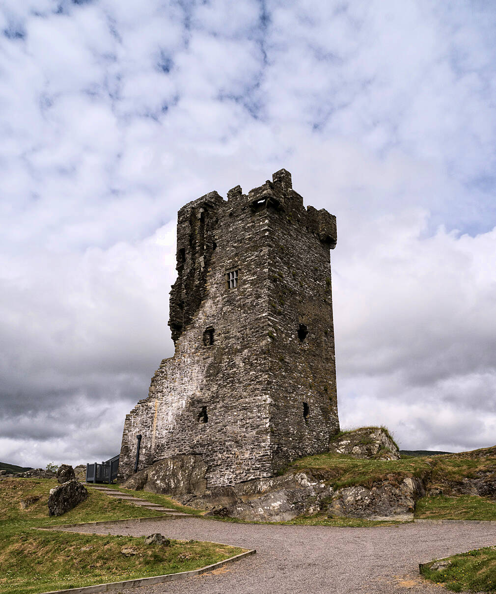
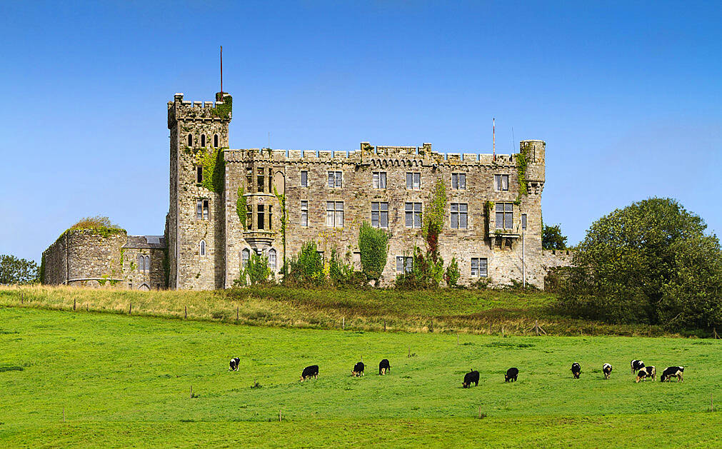
9| Castle Walk – Kilbrittain Trails
Kilbrittain Trails include four different routes of varying lengths. The Castle Walk is 3.7km long, starting and finishing at the village of Kilbrittain, which is located between Kinsale and Clonakilty.
The trail heads north and takes about one hour, along quiet roads with forest landscape and views of Coolmain Bay and Kilbrittain Castle. It is relatively flat and suitable for most walkers.
LENGTH/DURATION: 3.7km, one hour.
DIFFICULTY: Suitable for most fitness levels.
DIRECTIONS: Start and finish in Kilbrittain village. The Castle Walk is waymarked with red signs.
10| Timoleague to Courtmacsherry – Seven Heads
10| Timoleague to Courtmacsherry – Seven Heads The Seven Heads Peninsula extends from Timoleague to Courtmacsherry, andaround to Dunworley Bay, Barryscove, Ardgehane and Ballinglanna. The entire distance is about 42.5km with lots of different walkways along it. A great one to start with is from Timoleague village to Courtmacsherry, along the old railway line. This walk is very flat, perfect for kids, bikes and buggies.
LENGTH/DURATION: 10km, 1.5 hours approx over and back to the start.
DIFFICULTY: Easy, very flat
DIRECTIONS: Head to Timoleague where you can park near the picturesque Abbey. From there,follow the path with the estuary on your left, making your way