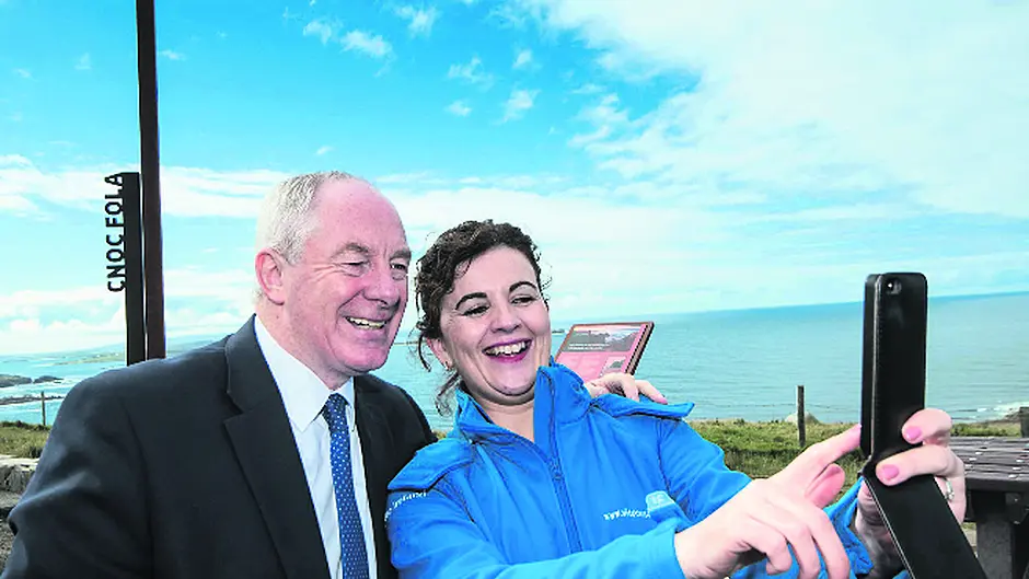
A number of areas in West Cork have been selected as ‘information points’ on the Wild Atlantic Way, to give them a better profile on the route.
By Siobhán Cronin
A NUMBER of areas in West Cork have been selected as ‘information points’ on the Wild Atlantic Way, to give them a better profile on the route.
The locations were unveiled last week, as part of a new €3.5m phase of the Wild Atlantic Way involving further development for the touring route’s 188 designated Discovery Points. It is planned to carry out roadworks and other enhancements at the sites and to have photo-friendly marker points and interpretation panels – explaining the significance of each point – installed at each location by next summer.
The 35 Discovery points in Co Cork which are due to benefit are Kenmare River View; Dooneen; Garnish Point; Dursey Island; Gour; Castletownbere Harbour; Pontoon Pier; Bere Island – east & west end piers; Whiddy Island View; Glengarriff Harbour; Blue Pool; Garinish Island; Bantry Harbour; Whiddy Island; Seefin Viewpoint; Sheep’s Head; Altar; Barley Cove; Mizen Head; Schull Harbour; Colla Pier; Cléire; Long Island; Sherkin Island; Heir Island; Cunnamore Pier; Baltimore Harbour; Inishbeg; Lough Hyne; Toe Head Bay; Galley Head; Inchydoney Beach; Timoleague Abbey; Old Head of Kinsale.
Fáilte Ireland has been working with Cork County Council to complete the upgrade of the Wild Atlantic Way’s designated Discovery Points. This work will involve the installation of photo points at all sites, which are designed to literally ‘frame’ the photographs taken by visitors at beauty spots and scenic views along the route.
The work will also involve the erection of sturdy weather-proof interpretation panels at each point, to tell the relevant stories for each particular area and Fáilte Ireland has worked with a number of communities along the route to bring these stories to life.
The interpretation panel will also include information advising visitors of other things to do and see in the area and will also include an orientation map of the immediate surrounding area.
Fáilte Ireland chief executive Shaun Quinn said he really wanted to improve the visitor experience along the Wild Atlantic Way and give visitors opportunities to learn from, engage with and share what they encounter in C. Cork. ‘The photo points, for example, are located at the most scenic spot of each Discovery Point and are intended to provide a sense of arrival at that place and encourage visitors to have their pictures taken with the spectacular scenery on hand in the background. We hope that this not only encourages them to engage with the view but also to share their images with friends and family online and via social media,’ he said.
The total national investment for the discovery points is €3.5m and it is expected that all work will be completed by local authorities in time for the 2016 tourism season. This project also includes a remedial works programme which will entail the repair of surfaces, boundary walls and fencing and the general tidying up and presentation of these sites.
During the original development of the Wild Atlantic Way route, a number of existing viewing points and lay-bys were identified and established as Wild Atlantic Way Discovery Points – including those designated in Co Cork. Fáilte Ireland worked with the relevant Councils along the route to carry out remedial works for each of these points to ensure that the sites were presentable for this year’s tourist season.
This latest announcement marks the next stage of development of these sites and will further enhance their appeal to visitors.
Significant capital funding was invested to develop the route in 2014, including €8m made available in Budget 2014 to the project. Much of this was invested in route signage and in establishing the discovery points along the way.
The Route Signage phase of the project was completed in June 2014 including the signage of the mainland Discovery Points. In total 3,850 signs were erected at 950 junctions along the 2,500km stretch of the route.


