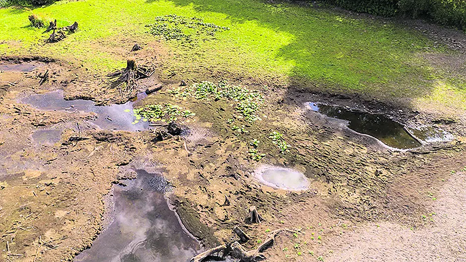
THE lack of management, protection and development of the Gearagh conservation site, 2km south-west of Macroom, was raised in the Upper House by Sen Colette Kelleher (Ind).
THE lack of management, protection and development of the Gearagh conservation site, 2km south-west of Macroom, and the Department of Culture, Heritage and the Gaeltacht’s lack of leadership and action was raised in the Upper House by Sen Colette Kelleher (Ind).
Speaking in the Senate, she said the Gearagh National Nature Reserve on the River Lee is a globally unique site of international importance, both for its primeval river forest and its wintering wildfowl.
As a priority Natura 2000 site under the EU Habitats Directive, it has several different forms of legislation theoretically protecting it. It is a special area of conservation, SAC, a special protected area, SPA, a world Ramsar site, a biogenetic reserve and part of the Lee Valley natural heritage area.
The Gearagh is a designated SAC to primarily protect its alluvial woodland, she said. However, the lack of good water management in the river catchment upstream from the forest, as required under Article 6(3) of the Habitats Directive, is causing the site’s islands to disintegrate.
‘This is flying in the face of the intended EU protection enshrined under Article 6(2),’ she said. ‘The SPA status was originally designated on the site due to the thousands of wintering wildfowl that used the area. Today, however, the numbers of wintering birds are much reduced.’
Replying on behalf of the Minster for Culture, Heritage & the Gaeltacht, Minister of State, Catherine Byrne said the Gearagh comprises a stretch of the River Lee that was dammed in the 1950s as part of a hydroelectric scheme.
‘The site is a statutory nature reserve in the ownership of the ESB,’ she said. ‘The qualifying interests of the special area of conservation site are floating river vegetation, old oak woodlands, alluvial forests and the otter. Despite about half the original area having been destroyed, the Gearagh still represents the only extensive alluvial woodland in Ireland, Great Britain or west of the River Rhine in Europe.’
She said the Department of Housing, Planning and Local Government convened a working group of key stakeholders for the Gearagh site in 2016, comprising representatives from that Department, the Department of Culture, Heritage and the Gaeltacht, Cork County Council and the ESB. It proposed a number of recommendations, including monitoring surveying and studies on the site to establish baseline data and for the development of a management plan.
‘Work commenced on the implementation of these recommendations in November 2017,’ she said. ‘To date, terrestrial laser scanning of the main channel flowing through the Gearagh site has been completed. Locations for a hydrometric gauge and depth loggers have been identified with installation due for completion by the end of this summer. Based on ongoing consultation between the ESB and the National Parks and Wildlife Service of the Department of Culture, Heritage and the Gaeltacht, further scientific studies are planned for the eastern section of the Gearagh site.’


