Weather behaves in a complex and chaotic manner, so it would be foolish to make any predictions for Christmas in West Cork this year just yet, warns Vincent O’Shea
HERE in West Cork, Ireland and throughout the British Isles, we are truly fortunate to enjoy such a moderate and benign climate.
It’s no wonder chatter on daily weather is an ongoing feature of our lives. Loathe it we may, but deep in our psyche is a great fondness for it.
We like its variability and overall regularity that afflicts few extremes. We marvel at whatever the weather throws up, be it a fine spring morn or a ‘fine soft day’. It seems to bring our emotions to the fore – ranging from short lived disappointment, to oft times cheeriness when lovely views fill us with bright new hopes over our horizons.
Major events such as hurricanes, tornadoes, intense thunderstorms, blizzards, heatwaves, droughts, wildfires … and the list goes on; whilst common in many parts of the world, are almost unknown here in Ireland. We are also devoid of natural disasters such as volcanos, earthquakes or avalanches.
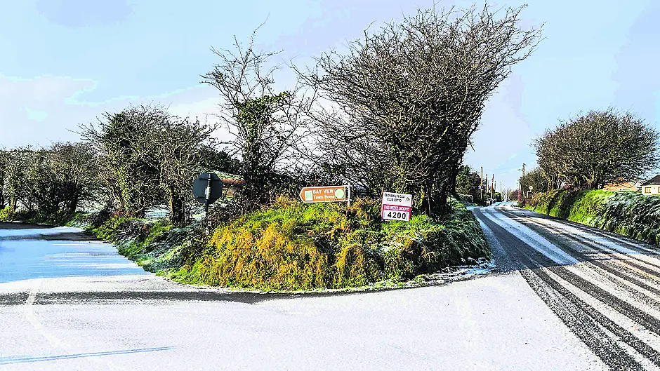
With the festive season fast approaching, our thoughts no doubt wander towards the possibility of a White Christmas in West Cork.
National weather services around the world use computer models to predict the state of the atmosphere beyond even one to two days.
The European Centre for Medium Range Weather Forecasting (ECMWF) – of which Met Eireann is a participating member – attempts to forecast the weather out to 10 days in advance. Useful forecasts are possible until about day six, but the accuracy falls off rapidly thereafter.
Meanwhile, the United Kingdom Met Office (UKMO) has been attempting seasonal forecasting in recent times, but with only limited success thus far.
As we all know, weather behaves in a complex and chaotic manner, so therefore it would be foolhardy to make any concrete prediction of Christmas’s weather in West Cork at this stage, with such a long lead-in time.
January and February are the months in which snow is most likely to occur in Ireland, though it is possible to get snow in any of the months from November to April.
The necessary conditions for snowfall include an Arctic maritime (Am) airmass that originates at high latitudes, or a Polar continental (Pc) one streaming out from Scandinavia and Siberia during the winter months.
These are cold, deep unstable layers of the troposphere that facilitate convection and result in showery conditions that produce snowfall if surface temperatures are close to zero degrees Celsius. These types of airmasses were responsible for the snowy episodes of 2010, and a slow-moving occlusion embedded in a Pc airflow was the cause of the ‘Beast from the East’ in 2018 – one of the most significant snowfalls in recent history. Sometimes a Polar maritime (Pm) airflow can bring wintry showers from the north Atlantic, but the West Cork area often remains dry clear and crisp in such conditions – courtesy of the Kerry mountains. West Cork enjoys something of a micro-climate, compared to other parts of the country. Winter months are noticeably milder, though at the expense of higher rainfall and windiness.
Even in the absence of recent warming trends, a White Christmas (lying snow) might only occur in any part of this country less than once in a decade, with a lesser likelihood at any single location. That chance becomes even smaller near Atlantic coasts, due to the influence of the Gulf Stream – what is effectively a warm heat reservoir in motion. Indeed, this includes all of West Cork and parts of south Kerry, where we have the most frost-free days.
Latest climatological data tells us that autumn of 2021 was the warmest on record over Ireland and Britain, and November was the fifth warmest globally.
Storm Arwen this year brought power outages and snowfall disruption to the UK, and especially Scotland, at the beginning of December and was widely documented in the media.
Another appropriately and alphabetically named Barra (named by Met Eireann) followed in from the Atlantic in the jet stream on the morning of December 6th and battered the country with damaging winds. Most of the country had some form of advance weather alert with counties Cork, Kerry and Clare falling into the rare ‘red’ tier.
True to expectation, West Cork and Kerry were worst affected, with the automatic weather station at Sherkin Island reporting a southerly gust of 135 km/h – the highest in the country. The gales felled trees and generated seas over 10 meters seen crashing over the Fastnet lighthouse. Flooding in Bantry was due to storm surge running up the bay alongside spring tides. That again highlights the vulnerability of our coastal towns to any future sea level rises and Climate Change. More than 50,000 homes and businesses countrywide reported loss of electricity, before the storminess transferred up to the west and north of the country.
It could be argued that these events get serious media attention as we haven’t seen any potent storm for the guts of two years, and maybe we are immersed in Covid news of late. However, it was not a record- breaking event and would have occurred many times in the past during winter months.
Furthermore, and notwithstanding an extensive icy Arctic airmass, West Cork would usually be one of the last places to get a big winter freeze and snowfall in this country.
Do keep an eye on forecasts from December 20th on or thereabouts, but I rest on my laurels and say that ordinarily, and being in a global warming scenario, the probability of a White Christmas this year is very slim.
Skibbereen native Vincent O’Shea MSc MBA is a meteorologist.


